Street Address
City, State, Zip
Phone Number
roar
Your Custom Text Here

Your Custom Text Here
Most of Catalonia belongs to the Mediterranean Basin. The Catalan hydrographic network consists of two important basins, the one of the Ebro and the one that comprises the internal basins of Catalonia, all of them flow to the Mediterranean. Furthermore, there is the Garona river basin that flows to the Atlantic Ocean, but it only covers 1.7% of the Catalan territory.
Photos by Shantanu Starick
Allihies is a coastal parish and townland in the west of County Cork, Ireland. The corresponding civil parish is Kilnamanagh. The largest village in the parish is Cluin, but is often mistakenly referred to by the name of the surrounding parish. Allihies Parish is located on the western tip of the Béara Peninsula and stretches between Cod's Head to the North West and Dursey Island to the South West. Allihies is the furthest village in Ireland from the capital, Dublin, some 394 km away by road.
Nulla vitae elit libero, a pharetra augue. Sed posuere consectetur est at lobortis. Nullam id dolor id nibh ultricies vehicula ut id elit. Integer posuere erat a ante venenatis dapibus posuere velit aliquet. Donec sed odio dui. Praesent commodo cursus magna, vel scelerisque nisl consectetur et.
Photos by Shantanu Starick
The district dates back to the Oberamt Esslingen, which was created when the previously free imperial city Esslingen became part of Württemberg in 1803. After several changes over the next century, it was converted into a district in 1938. Additionally, it was enlarged by adding several municipalities from the neighboring Amtsoberamt Stuttgart, Oberamt Schorndorf, Kirchheim unter Teck and Göppingen.
Etiam porta sem malesuada magna mollis euismod. Nullam id dolor id nibh ultricies vehicula ut id elit. Maecenas sed diam eget risus varius blandit sit amet non magna. Praesent commodo cursus magna, vel scelerisque nisl consectetur et. Morbi leo risus, porta ac consectetur ac, vestibulum at eros.
Photos by Shantanu Starick
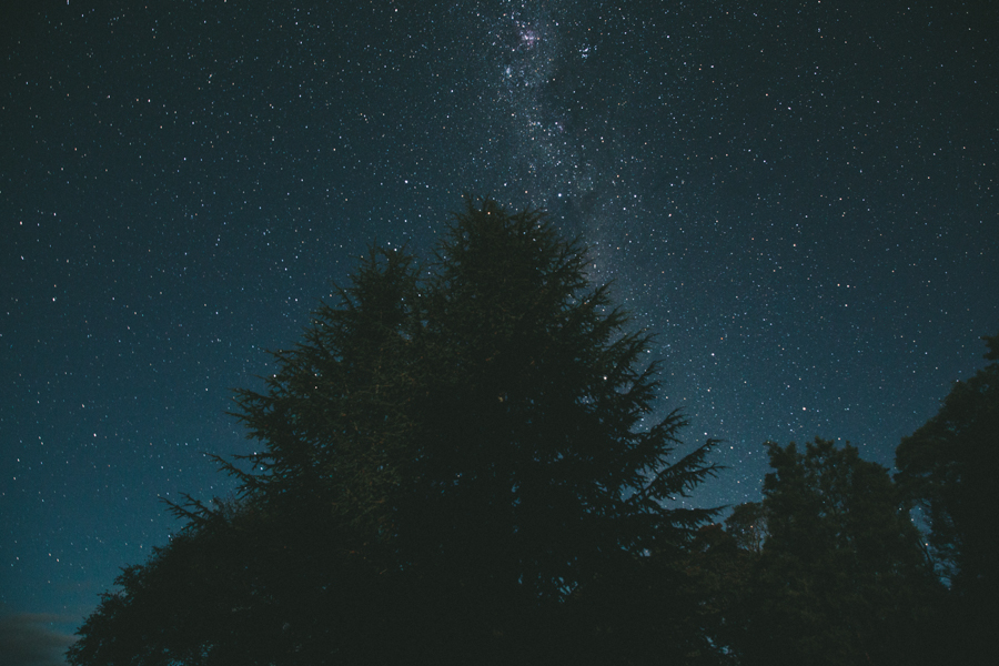
Tasmania (abbreviated as Tas and known colloquially as "Tassie") is an island state, part of the Commonwealth of Australia, located 240 kilometres to the south of the Australian continent, separated by Bass Strait. The state includes the island of Tasmania, the 26th largest island in the world, and the surrounding 334 islands. The state has a population of 507,626 (as of June 2010), of whom almost half reside in the greater Hobart precinct. Tasmania's area is 68,401 square kilometres, of which the main island covers 64,519 square kilometres.
Tasmania is promoted as the natural state, and A World Apart, Not A World Away owing to its large and relatively unspoiled natural environment. Almost 45% of Tasmania lies in reserves, national parks and World Heritage Sites. The island is 364 kilometres long from its northernmost to its southernmost points, and 306 kilometres from east to west.
Photos by Shantanu Starick
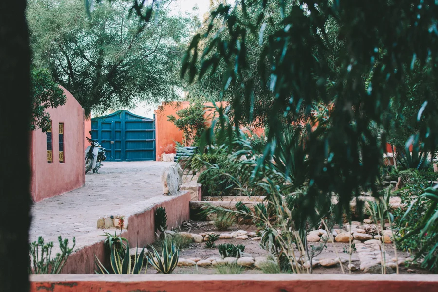
The city was known in the time of 11th-century Geographer al-Bakri and, as he reported, was called Sidi Megdoul. In the 16th-century, a corruption of this name became known to the Portuguese as Mogador or Mogadore. The Berber and Arabic names mean the wall, a reference to the fortress walls that originally enclosed the city.
Fusce dapibus, tellus ac cursus commodo, tortor mauris condimentum nibh, ut fermentum massa justo sit amet risus. Aenean eu leo quam. Pellentesque ornare sem lacinia quam venenatis vestibulum. Nullam quis risus eget urna mollis ornare vel eu leo. Aenean eu leo quam. Pellentesque ornare sem lacinia quam venenatis vestibulum. Donec id elit non mi porta gravida at eget metus.
Photos by Shantanu Starick
Byron Bay is a beachside town located in the far-northeastern corner of the state of New South Wales, Australia. It is located 772 kilometres (480 mi) north of Sydney and 165 kilometres (103 mi) south of Brisbane. Cape Byron, a headland adjacent to the town, is the easternmost point of mainland Australia. At the 2006 Census, the town had a permanent population of 4,981. The town is in turn the nucleus of Byron Shire, which has in excess of 28,000 residents.
The local Arakwal Aboriginal people's name for the area is Cavvanbah, meaning "meeting place". Lieutenant James Cook named Cape Byron after John Byron, circumnavigator of the world and grandfather of the poet Lord Byron.
Photos by Shantanu Starick
Integer posuere erat a ante venenatis dapibus posuere velit aliquet. Morbi leo risus, porta ac consectetur ac. Cras justo odio, dapibus ac facilisis in, egestas eget quam. Nullam id dolor id nibh ultricies vehicula ut id elit. Donec sed odio dui. Praesent commodo cursus magna, vel scelerisque nisl consectetur et. Nullam id dolor id nibh ultricies vehicula ut id elitr. Praesent commodo cursus magna, vel scelerisque nisl consectetur et.
Curabitur blandit tempus porttitor. Curabitur blandit tempus porttitor. Maecenas faucibus mollis interdum. Lorem ipsum dolor sit amet, consectetur adipiscing elit. Duis mollis, est non commodo luctus, nisi erat porttitor ligula, eget lacinia odio sem nec elit. Duis mollis, est non commodo luctus, nisi erat porttitor ligula, eget lacinia odio sem nec elit. Duis mollis, est non commodo luctus, nisi erat porttitor ligula, eget lacinia odio sem nec elit. Curabitur blandit tempus porttitor.
Photos by Shantanu Starick
SPONTANEOUSLY ROASTED IN BETH’LEM/KEYSTONIA/LENAPEHOKING.